
Nearly 80,000 people in Nevada woke up to warnings about dangerous driving conditions Wednesday morning as freezing fog spread across parts of the state.
National Weather Service (NWS) senior meteorologist Bill South told Newsweek that freezing fog is uncommon for this time of year in Nevada because the region “very rarely” has enough low-level moisture for it to form.
Why It Matters
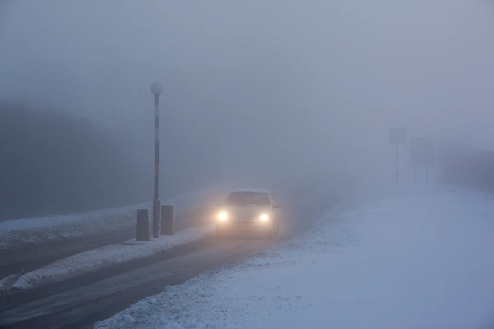
The NWS issued freezing fog advisories for multiple areas in Nevada, cautioning that visibility could drop quickly and roads could become slick as moisture freezes on cold surfaces. The alerts cover major population centers and key transportation routes, raising risks for commuters, commercial drivers, and residents during the busiest morning travel window. Early-season fog advisories like this highlight the need for caution as winter conditions build across the western United States.
What To Know
Urgent weather messages from NWS offices in Reno and Elko said visibility in affected areas fell below one mile Wednesday morning. Advisories were scheduled to remain in effect until 9 a.m. PST and included:
- Greater Reno–Carson City–Minden area
- Western Nevada Basin and Range, including Pyramid Lake
- Humboldt County, including Golconda, Dufferena, Valmy, and Winnemucca
Additional communities noted as impacted included Lovelock, Sparks, Imlay, Virginia City, Silver Springs, Fallon, Gardnerville, Nixon, Fernley, and Verdi.
The advisory warnings emphasize sharply reduced visibility and the potential for icy road conditions as fog moisture freezes on contact.
“Visibility less than one mile in freezing fog,” NWS Reno said in its advisory. “Low visibility and slick roads could make driving conditions hazardous.”
The NWS office in Elko delivered a similar message for Humboldt County: “Low visibility could make driving conditions hazardous.”
“Please slow down as you travel across portions of Humboldt county this morning,” the advisory added.
Drivers were urged to watch for sudden pockets of dense fog and icy pavement—especially in valleys and basin areas where cold air tends to settle and support freezing fog formation.
What People Are Saying
NWS Elko (freezing fog advisory): “If driving, slow down, use your headlights, and leave plenty of distance ahead of you.”
NWS Elko (post on X): “Patchy, dense freezing fog will continue across portions of Humboldt county, including roads like I-80, US Highway 95, and SR140. The freezing fog will reduce visibilities at times to one mile or less. Travel will be difficult, please use caution if driving this morning.”
NWS Reno (post on X): “Fog and Freezing Fog will develop in many valley locations overnight, with the highest chances (90%+) in the Martis and Carson Valleys, with a 60 percent chance elsewhere in W NV and the Sierra. Rapid visibility drops are possible along with icy roadways/bridges for the Wed AM commute.”
What Happens Next
The freezing fog advisories were set to expire by 9 a.m. PST, with conditions expected to improve as temperatures rise and daylight helps thin the fog.
Even so, the NWS urged residents and travelers to stay alert for changing conditions through the morning, noting that updates may be issued through official alerts and weather channels.
South also said freezing fog could return Thursday night, though forecasting it far in advance can be difficult.


