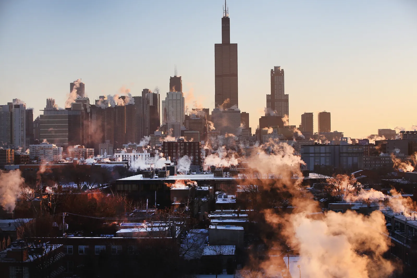
Chicago may be heading into its harshest early winter in nearly a century and a half, with one forecast model suggesting temperatures could plunge to -14 degrees Fahrenheit in the days ahead, according to a prominent weather blogger.
Why It Matters
Midwesterners are used to icy winters, and Chicago typically sees an average December high of about 36.6 degrees Fahrenheit and a low near 24.4, based on National Weather Service records. This upcoming pattern is different: one meteorologist told Newsweek that in some locations, temperatures could fall as much as 30 degrees below what’s normal for this time of year.
What to Know
“If you continue stretching the polar vortex, eventually it will let loose obscenely cold air. By next weekend into following week, the bottom drops out completely with coldest early December temperatures since 1876 in Chicago,” Weather Trader’s Ryan Maue wrote Sunday on X.
In a follow-up post, Maue pointed to a forecast model that projected a low of -14 degrees in Chicago on December 8. Historically, the city’s earliest -14-degree reading was logged on December 9, 1876. Chicago came close in 1903, when the temperature dipped to -13 degrees on December 13.
AccuWeather lead long-range expert Paul Pastelok explained to Newsweek that, at this time of year, upper-stratospheric winds usually blow from west to east, circling counterclockwise around a low-pressure area known as the polar vortex. When the vortex is strong early in the season, it helps trap the coldest air near the pole and keeps the lower polar jet stream relatively flat, limiting how far south Arctic air can plunge.
However, Pastelok said that when the polar vortex weakens in late fall and early winter, that steady westerly flow is more easily disturbed. “The flow slows and sometimes can turn easterly, which occurred on November 28th,” he noted.
That shift allows more “dips and wobbles” in the polar jet stream lower in the atmosphere, which in turn steers frigid air masses across the globe.
“In early winter scenarios, it does not take as long to see a reaction from this disruption. Later in the winter, sometimes it takes two to three weeks,” Pastelok said. “In the coming weeks, we will see a reaction to this disruption with some strong cold shots. However, there are other factors involved that will contribute to bitter cold surges, or near record temperatures.”
According to Pastelok, the most intense cold is likely to hit from the northern Plains into the Midwest. During any of three expected cold waves—this week, early next week, and early in the week of December 15—temperatures could run 15 to 30 degrees below normal.
He added that some locations could experience “the coldest early December period on record,” driven not only by the disrupted polar vortex but also by other influences such as La Niña.
What People Are Saying
On Sunday, Maue described the coming outbreak on X as a “World class ‘polar vortex’ Arctic blast for early December,” adding: “We can’t get any colder or more brutal without going back to the days of the ‘wooly mammoths’ and mastodons. And into mid-December, it’s only going to get worse. We’re in for the worst start to winter since 1876.”
What Happens Next
Residents are urged to keep a close eye on updated forecasts. Regional National Weather Service offices will continue to issue the latest information on temperatures, wind chills, and any winter storm hazards through their website and social media channels.