A powerful winter storm is moving through parts of Alaska, the Midwest, and the Northeast this weekend, bringing heavy snow, strong winds, and treacherous travel conditions.
Eight states are under winter storm warnings or winter weather advisories: Alaska, Wisconsin, Michigan, Maine, Massachusetts, New Hampshire, New York, and Vermont.
Alaska is expected to take the hardest hit, with snowfall totals climbing as high as 26 inches in some locations and conditions described by forecasters as “very hazardous.”
How Long Warnings and Advisories Will Last
The storm is expected to be most intense Saturday afternoon and evening, with impacts continuing into early Sunday across most affected areas.
In Alaska, hazardous weather may persist through Sunday morning. Northern Maine could remain impacted into early Monday.
The most dangerous travel conditions are expected overnight and early Sunday, when snow and ice are most widespread.

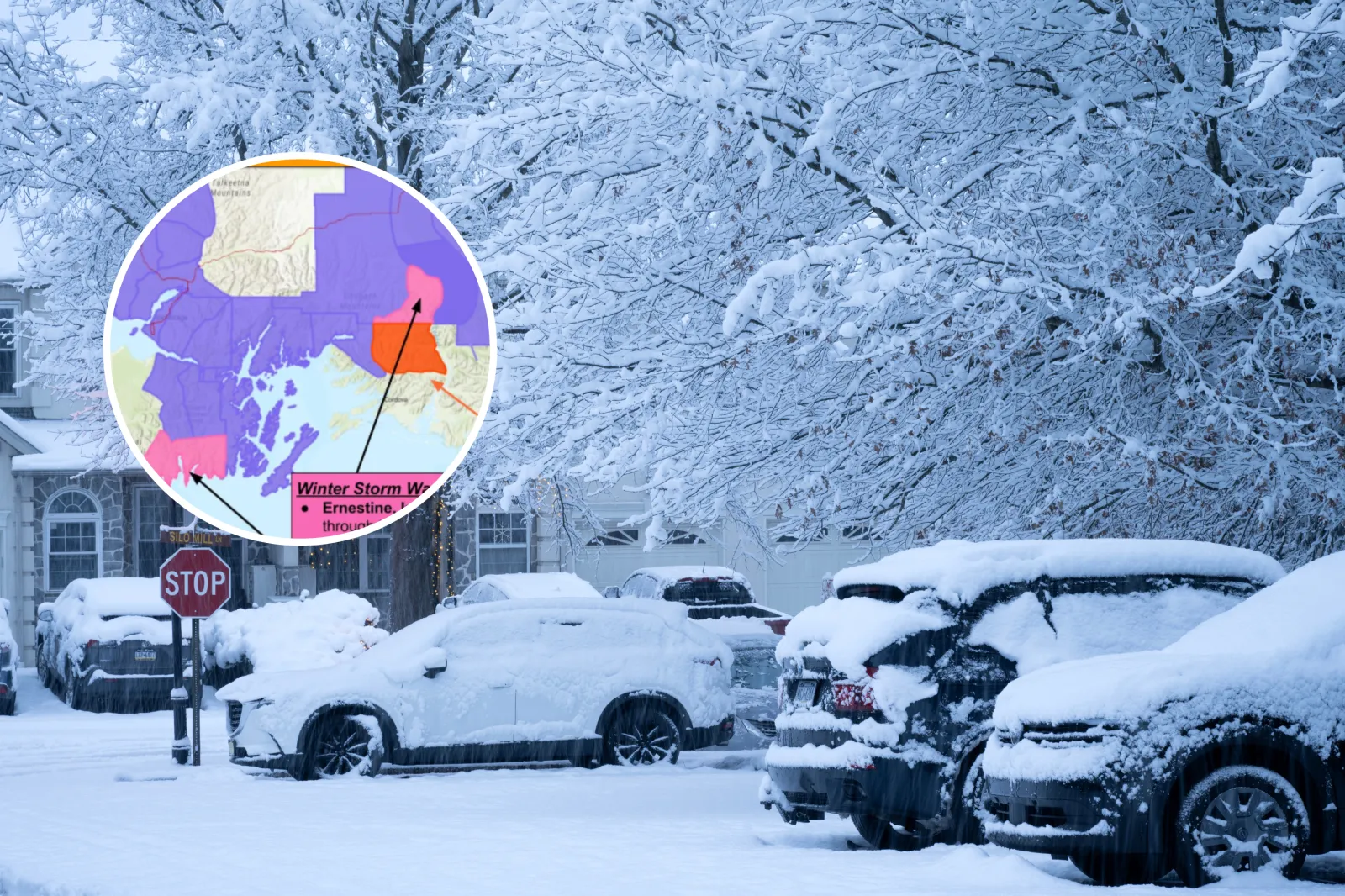
Alaska
Alaska faces the most extreme conditions in this storm cycle. Thompson Pass near Ernestine could pick up 12 to 26 inches of snow through midday Saturday, making travel close to impossible. The National Weather Service warned: “Severe winter weather conditions will make travel very hazardous.”
Seward and the Southern Kenai Mountains are expected to see 8 to 20 inches of snow, along with wind gusts up to 40 miles per hour that could reduce visibility to half a mile or less.
Valdez may receive 14 to 24 inches of snow through early Sunday. The Susitna Valley and Hatcher Pass could see up to 18 inches, with isolated pockets near 24 inches north of Talkeetna.
Blowing snow is expected in many areas, and occasional freezing rain is possible—especially near Turnagain Arm and along coastal zones.
Hazardous conditions could linger through Sunday morning. Residents are urged to avoid unnecessary travel, secure outdoor items, and prepare for possible power disruptions.
Wisconsin
Door County remains under a winter storm warning through early Sunday, with 4 to 7 inches of snow expected. Roads may become slick quickly, and visibility could drop during heavier bursts.
Southern and Northern Marinette County, along with Brown, Kewaunee, Calumet, and Manitowoc counties, are under winter weather advisories for 2 to 4 inches of snow.
Drivers should reduce speed and allow extra time to reach their destinations.
Michigan
Winter weather advisories cover much of Michigan.
In the Upper Peninsula, totals of 3 to 6 inches are expected, with locally higher amounts of 4 to 8 inches possible in Marquette and Baraga counties. Wind gusts up to 35 miles per hour may lead to blowing and drifting snow. The advisory there continues until early Sunday morning.
Northern Lower Michigan is expected to see similar totals, with some areas beginning as freezing drizzle before changing over to snow.
West-central areas—including Muskegon and Ludington—could receive 3 to 5 inches. Travel may become especially difficult Saturday night into Sunday morning. The National Weather Service advised: “Slow down and use caution while traveling.”
Maine
Northern and interior Maine may see 4 to 7 inches of snow from early Sunday into Monday.
Along the coast, precipitation is expected to mix with sleet and freezing rain, with a light glaze of ice possible.
Roads could be slippery and untreated surfaces especially hazardous. Residents should plan for slow travel and watch for icy patches on bridges, steps, and walkways.
Massachusetts
Western Massachusetts—particularly the Berkshires and the northern Worcester Hills—faces the greatest icing threat.
Freezing rain is possible from Saturday evening through Sunday morning, with up to two-tenths of an inch of ice in higher elevations.
Even minor ice buildup can make roads dangerous and increase the chance of power outages, forecasters warned.
New Hampshire
Central and southern New Hampshire are expected to see a mix of precipitation from Saturday evening into Sunday, including light snow, sleet, and up to one-tenth of an inch of ice.
Slippery roads and reduced visibility could make overnight travel hazardous.
New York
Northern Herkimer and Hamilton counties—along with parts of Saratoga and Warren counties—are under advisories for a wintry mix from Saturday evening into Sunday morning.
Forecasts call for up to two inches of snow and sleet, plus around two-tenths of an inch of ice. Drivers should be prepared for slick roads and the possibility of scattered outages.
Vermont
Bennington and western Windham counties, along with parts of Rutland and Windsor counties, could see freezing rain and light snow overnight into Sunday morning.
Ice accumulations up to two-tenths of an inch are possible, which can make travel dangerous and add strain to trees and power lines.
Winter Storm Warning vs. Winter Weather Advisory
A winter storm warning means dangerous winter weather is happening or expected soon—such as heavy snow, strong winds, or damaging ice—often with major impacts to travel and daily routines.
If you’re in a warning area, it’s best to adjust plans: delay trips, reschedule outdoor work, and prepare for potential power outages.
A winter weather advisory signals less extreme conditions, but still enough to cause disruptions. Lighter snowfall or mixed precipitation can still create slick roads, sudden visibility drops, and hazardous icing—especially overnight and in the early morning hours.