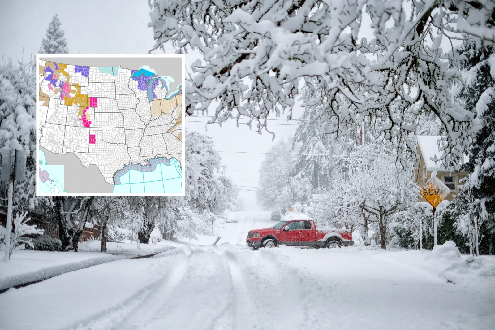
Winter storm warnings are in effect for five states, with dangerous conditions expected in multiple regions, according to the National Weather Service (NWS).
Forecasters say intense winter systems could bring up to three feet of snow, whiteout conditions, and damaging winds through Saturday. Hazardous travel and potential impacts to utilities and infrastructure are also possible, based on NWS bulletins.
The warnings indicate a risk of life-threatening weather, particularly at higher elevations and along major mountain passes. The NWS cautions that very heavy snow combined with strong winds and blowing snow may lead to impassable roads, widespread transportation disruptions, power outages, and a heightened avalanche risk.
Several affected areas include key interstate routes and popular recreation destinations, arriving as holiday travel nears—raising concerns about readiness and emergency response.
States Under Winter Storm Warnings
Washington
Multiple warnings have been issued for the Cascades, including Snoqualmie Pass, Stevens Pass, and Mount Rainier. Heavy snow is expected, with totals ranging from one to three feet—highest at upper elevations such as Paradise and Mount Baker. Warnings run from 4 a.m. Friday to 4 p.m. PST Saturday, with difficult travel likely.
Oregon
The east slopes of the Oregon Cascades—including Sisters and Sunriver—are under a winter storm warning. Forecast snowfall ranges from six to 10 inches, beginning at 4 a.m. PST Friday and lasting until 10 a.m. PST Saturday. Drivers are advised to avoid travel due to slick roads and the potential for downed trees.
Idaho
Mountain locations including the Sawtooth/Stanley Basin and Sun Valley could see one to two feet of snow above 7,000 feet, with wind gusts up to 45 mph. Lower elevations below 7,000 feet may still pick up several inches, including roughly five to eight inches in Stanley and Ketchum. The warning remains in effect until 5 a.m. MST Saturday, and backcountry travel is expected to be “very difficult to impossible.”
Montana
Warnings cover the Absaroka/Beartooth and Bitterroot/Sapphire Mountains. Snow totals may range from eight to 14 inches at Lolo Pass to 16–24 inches at Lost Trail Pass, along with winds up to 45 mph and increasing avalanche danger. Alerts extend through 5 p.m. MST Friday, and major disruptions are expected on mountain passes. The NWS also warns that gusty winds could bring down branches and trigger power outages.
Wyoming
The most severe conditions are expected in Wyoming’s mountain ranges, including Yellowstone, the Tetons, and the Wind River Range. Two to three feet of snow is possible, with isolated totals above three feet, plus wind gusts up to 55 mph. Warnings remain in effect until 5 a.m. MST Saturday. Blowing and drifting snow is likely, and backcountry travel is discouraged.
Additional Winter Weather Advisories
Mid-Atlantic
Garrett County, Maryland, and parts of West Virginia may see two to four inches of snow with gusts up to 60 mph from 10 a.m. to 10 p.m. EST Friday, potentially affecting evening travel.
Great Lakes Region
Advisories across Michigan, Wisconsin, and Minnesota warn of slick roads, blowing snow, and flash-freeze potential. Parts of Northern Lower Michigan could receive up to four inches of snow and gusts near 45 mph through Friday afternoon. Advisories in northern Wisconsin and Minnesota are expected to expire early Friday.
New York and Pennsylvania
Lake-effect snow could bring three to six inches to western New York and northwestern Pennsylvania, with gusts up to 45 mph. Treacherous conditions are possible during the evening commute. Advisories run from late Friday morning through early Saturday.
Pacific Northwest
In addition to the winter storm warnings, advisories in Washington and Oregon call for six to 16 inches of snow above roughly 2,500–3,000 feet, with gusts up to 40 mph from early Friday through Saturday morning.
Northern Rockies
Idaho’s Lemhi County and Montana’s Continental Divide may see six to 12 inches of snow at passes and up to 20 inches in higher terrain, with winds up to 55 mph. Advisories remain active through Friday evening.
Wyoming (Additional Areas)
Jackson Hole, Star Valley, and the Upper Green River Basin Foothills may receive four to 14 inches of snow with gusts up to 45 mph through Saturday morning, adding to already hazardous conditions.
What Happens Next
In most areas, the storm impacts are expected to continue into Saturday morning. Officials across affected states urge residents to prepare for rapidly changing conditions and to use extra caution, especially when traveling.