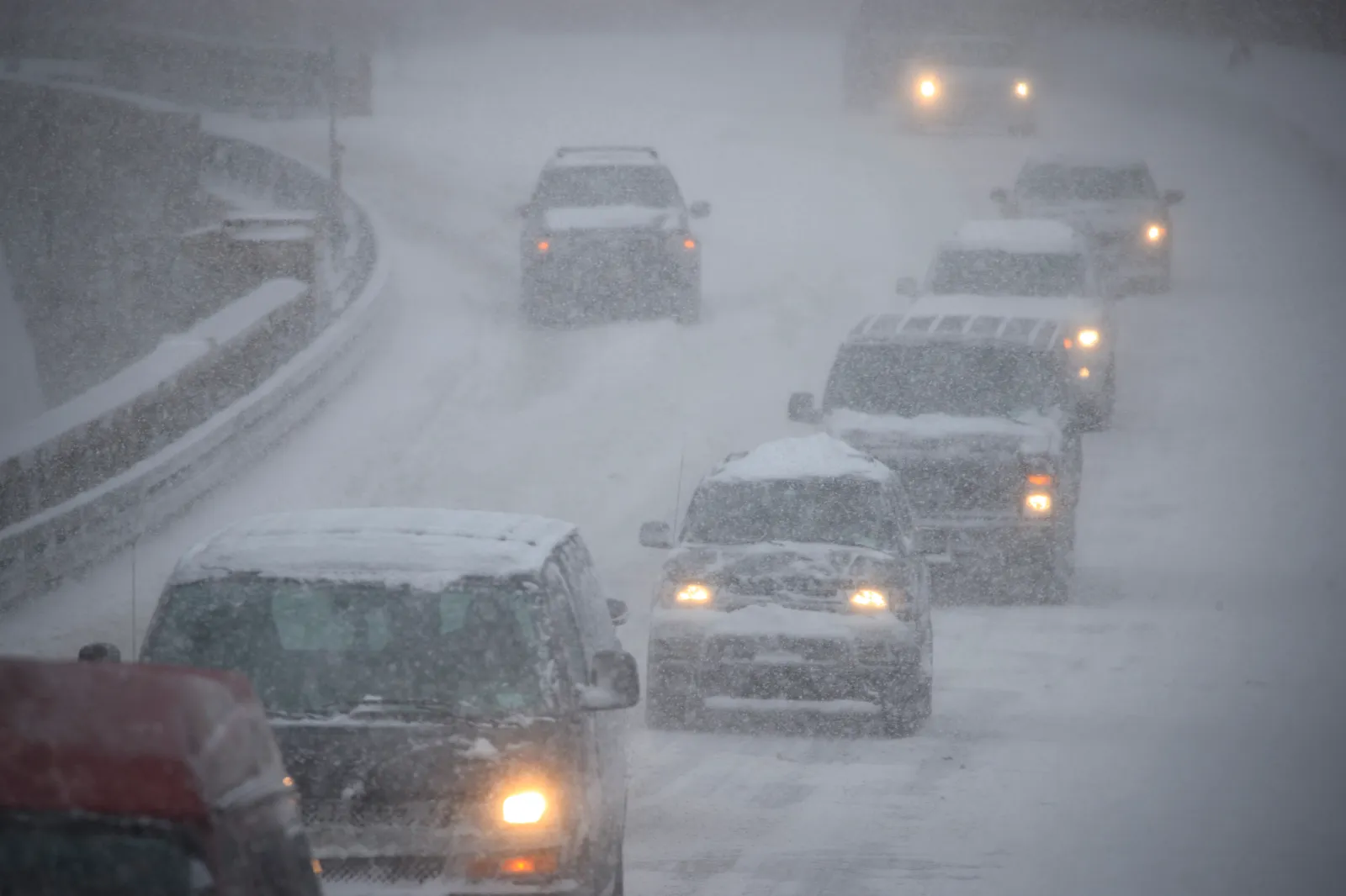
Up to 17 inches of snow is forecast to hit parts of the United States from Tuesday through Thursday, prompting the National Weather Service (NWS) to issue a series of winter storm warnings and urge travelers to “drive with extreme caution” or, where possible, postpone their plans.
Why It Matters
Strong winter storms can bring heavy snow, ice, and strong winds that sharply reduce visibility and make roads slick or even impassable. These conditions pose serious risks for drivers, especially during busy commute hours in the morning and evening, and can disrupt daily life, flights, and emergency services.
What To Know
NWS winter storm warnings are in effect for multiple regions across the country. The most heavily impacted states include Maine, New Hampshire, Colorado, Montana, Wyoming, South Dakota, Alaska, and New Mexico.
Maine and New Hampshire
Parts of south central, southwest, and western Maine, along with central, northern, and southern New Hampshire, are expected to see between 6 and 9 inches of snow by early Wednesday morning. This level of accumulation could lead to slick roads, reduced visibility, and hazardous travel overnight and into the Wednesday commute.
Colorado
In Colorado, the Sangre de Cristo Mountains are forecast to receive up to 17 inches of snow from Wednesday morning through Thursday morning, with the NWS warning that travel may become “very difficult to impossible” in these areas.
- Northern Colorado & Front Range:
- Larimer County, including Fort Collins, could see 2 to 4 inches of snow through Wednesday afternoon.
- Boulder, the Denver metro area, Castle Rock, and the Palmer Divide may receive up to 6 inches, with around 8 inches possible at the base of the foothills through Wednesday evening.
- Front Range Foothills & South Park:
- Southern Front Range Foothills: 5 to 11 inches of snow by Wednesday night.
- Northern Front Range Foothills: up to 8 inches.
- South Park region: up to 6 inches of accumulation.
- Southern Colorado:
The Wet Mountains, Wet Mountain Valley, Walsenburg vicinity, Upper Huerfano River Basin (below 7,500 feet), Trinidad vicinity, and western Las Animas County (below 7,500 feet) could see up to 10 inches of snow from Wednesday morning through Thursday. - South-Central Colorado:
- La Garita Mountains (above 10,000 feet) and eastern San Juan Mountains (above 10,000 feet): 3 to 9 inches of snow by Thursday morning.
- Upper Rio Grande Valley and eastern San Juan Mountains below 10,000 feet could see similar totals.
- Parts of Fremont County may receive 3 to 9 inches by Wednesday night.
- The San Luis Valley could see up to 5 inches by Thursday morning.
Montana, Wyoming, and South Dakota
In portions of Montana and Wyoming, particularly the northern and northeastern Bighorn Mountains, up to 3 inches of snow is expected through Wednesday morning, accompanied by winds up to 35 mph. These gusts may cause areas of blowing snow and reduced visibility.
Across Montana’s higher terrain, most mountain passes are forecast to see 2 to 4 inches of snow, with 5 to 8 inches possible over Kings Hill Pass by Wednesday morning. The NWS has cautioned that travel could be difficult, especially along Highway 14 through Burgess Junction.
The Wyoming Black Hills and South Dakota’s northern Black Hills could receive up to 5 inches of snow by Wednesday morning, creating slippery roads and localized travel disruptions.
Alaska
In Alaska, eastern Norton Sound and the Nulato Hills south of Shaktoolik may see up to 2 inches of snow, while the Middle Yukon Valley could receive up to 4 inches. Both areas may experience wind gusts near 40 mph through Wednesday afternoon, leading to drifting snow and lower visibility.
The eastern Alaska Range south of Trims Camp and the southern Denali Borough are expected to pick up as much as 5 inches of snow with winds up to 45 mph through Wednesday. Summits along the Dalton Highway, as well as the Yukon Uplands, White Mountains south of the Yukon River, and the Yukon Flats, may get up to 4 inches of snow.
New Mexico
In New Mexico, several mountain ranges and high passes are bracing for significant snowfall:
- Sangre de Cristo Mountains
- Tusas Mountains (including Chama)
- Glorieta Mesa (including Glorieta Pass)
- Upper Rio Grande Valley
- Johnson and Bartlett Mesas (including Raton Pass)
- Northeast Highlands
Areas above 7,500 feet could receive up to 8 inches of snow, with as much as 10 inches possible on the highest peaks of the Sangre de Cristo Mountains by Thursday morning.
What Happens Next
Residents and travelers in the affected states are urged to keep a close eye on updated forecasts and alerts from the NWS and local authorities. Officials recommend adjusting travel plans where possible, preparing emergency kits for vehicles, and ensuring homes and cars are ready for several days of winter weather and potentially difficult road conditions.